
Showing posts with label Sunset. Show all posts
Showing posts with label Sunset. Show all posts


Putrajaya - Pullman - Sunset - Putrajaya
 |
| Pullman Putrajaya |
 |
| Pullman Putrajaya |
 |
| Pullman Putrajaya |
 |
| Pullman Putrajaya |
 |
| Pullman Putrajaya |
Pullman Putrajaya
Pullman Putrajaya Pullman Putrajaya
Pullman
Putrajaya
Putrajaya - Puchong - Sunset
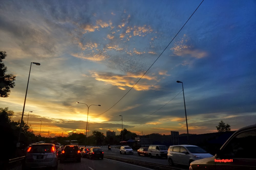 |
| Putrajaya - Puchong - Sunset |
 |
| Putrajaya - Puchong - Sunset |
 |
| Putrajaya - Puchong - Sunset |
Putrajaya–Cyberjaya Expressway, Federal Route 29 is a major expressway in Klang Valley, Malaysia and become the first future federal highway on the Multimedia Super Corridor (MSC) area. It connects Serdang interchange on Damansara-Puchong Expressway to Kuala Lumpur International Airport (KLIA) in Sepang. It was named after the two sides of the MSC cities, Putrajaya and Cyberjaya
The kilometre marker for the expressway is a continuation from the E11 Damansara-Puchong Expressway; therefore, the Putrajaya–Cyberjaya Expressway assumes the same Kilometre Zero as the Damansara-Puchong Expressway
Formerly the road was known as the
B15
Jkr-ft--.png state road from Puchong to Dengkil. Construction began in 1997 and was divided into four phases. The first phase was from the Damansara-Puchong Expressway to the Persiaran Utara interchange, the second from Persiaran Utara to Dengkil, the third from Dengkil to Sepang and the fourth from Sepang to Kuala Lumpur International Airport (KLIA). Phase 1 was completed in 1999, phase 2 in 2001 and phase 3 in 2006. Meanwhile phase 4, connecting Sepang to KLIA, is expected to be completed in 2009.
Sunset Putrajaya HDR

" Hi..if you are here for the first time and come from a search engine, welcome to my HDR photography blog. You will find my daily photography activity in HDR here mostly around Kuala Lumpur and Selangor. Click on HOME button on top menu to view thumbnail of my latest HDR photo. You may use these photographs with credit and links back to Momoc HDR Photography, no commercial use without permission. Thank you."
Putrajaya Lake Sunset Vertorama HDR Photography
This is HDR photography of sunset at the Putrajaya Water Recreation Centre after a week of cloudy, at last the clear sky comes. Everytime I come to this place, it always cloudy or raining. This HDR photo taken by stitching 2 photo below and above or in photography we called it vertorama. This Putrajaya Water Recreation Centre provides a range of activities such as fishing and kayaking in addition to a dining area for relaxing family weekend.
Sunset Putrajaya Sony

Sunset or sundown is the daily disappearance of the Sun below the horizon in the west as a result of Earth's rotation.
The time of sunset is defined in astronomy as the moment when the trailing edge of the Sun's disk disappears below the horizon in the west. The ray path of light from the setting Sun is highly distorted near the horizon because of atmospheric refraction, making the sunset appear to occur when the Sun’s disk is already about one diameter below the horizon. Sunset is distinct from dusk, which is the moment at which darkness falls, which occurs when the Sun is approximately eighteen degrees below the horizon. The period between sunset and dusk is called twilight.
Locations north of the Arctic Circle and south of the Antarctic Circle experience no sunset or sunrise at least one day of the year, when the polar day or the polar night persist continuously for 24 hours.
Sony Sunset Putrajaya

Sunset view very interesting. Ambik photo of the bridge that connects from precinct 8 to precinct 3 8government administrative buildings.
If the view is very beautiful mosque iron eyes. this point many who likes because of its beautiful sky with the beautiful colors.
Sharing this picture just to be shared with because I know the world is still in the learning or DSLR camera ....
Bangi Perdana - sunset

Bangi is a small town situated on the south of the district of Hulu Langat, in Selangor, Malaysia. It is roughly situated between the towns of Kajang (9 kilometres away) and Putrajaya (formerly Prang Besar) (also 9 kilometres away), and is linked to KTM Komuter commuter train services via the Bangi Komuter station. The town is surrounded by palm oil estates; a Malaysian Palm Oil Board/UKM research station is also based close to the town.
Bangi is not to be confused with Bandar Baru Bangi, a newer and larger township several kilometres north, similar to the town only by name and located closer to Kajang.
Bandar Baru Bangi (literally translated from Malay to English as New Bangi Town) is a township - recently crowned as "Knowledge City" - situated in the district of Hulu Langat, in Selangor, Malaysia, named after the small town of Bangi situated further south. It is located between Kajang and Putrajaya (formerly Prang Besar) and is about 25 km away from the capital city, Kuala Lumpur. The planning for Bandar Baru Bangi is based in Structure Plan, Local and Action Area Plan, Town Centre Urban Plan and the Town Park Plan prepared by international teams led by Peter Verity of PDRc Architects and Urbanists for the State Planning Department and PKNS.
Bandar Baru Bangi has education institutions, national institutions and agencies, corporate institutions, factories and industrial training centres. It also houses a five-star hotel, Hotel Equatorial with an 18-hole golf course.
PICC Lake Presint 5

The view of Putrajaya International Convention Centre (PCC) from Jambatan Seri Gemilang Bridge. PCC is located atop Taman Puncak Selatan, a circular hill park in Precinct 5 (Presint 5).
The location of the Putrajaya International Convention Centre is on top of Taman Puncak Selatan in Precinct 5, the Sports and Recreational Precinct that will be home for residential neighbourhoods and waterfront developments. Precinct 5 is located at the south of the core island. It is the culmination of the main axis that runs from Perdana Putra i.e. the Prime Minister's Office (Pejabat Perdana Menteri), to Dataran Putra, along the main boulevard and major public squares and across the Jambatan Seri Gemilang bridge over the lake. Taman Puncak Selatan terminates this axis and this commanding hill provides an impressive setting for the Putrajaya International Convention Centre.
Putrajaya International Convention Center, PCC / PICC,
(Pusat Konvensyen Antarabangsa Putrajaya),
Precinct 5 (Presint 5),
62000 Putrajaya, Malaysia.
Presint 9

Malaysia began its search for a new Government administrative centre in the 1980s to disperse some development away from Kuala Lumpur. A site at Prang Besar in the district Sepang was chosen, in view of its strategic location between Kuala Lumpur and Kuala Lumpur International Airport (KLIA). The New Federal Government Administrative Centre is named as “Putrajaya” in honour of Malaysia first Prime Minister, YTM Tunku Abdul Rahman Putra al-Haj, for his invaluable contributions to the nation.
While Kuala Lumpur will remain as the country’s capital city as well as premiere financial and commercial centre, Putrajaya will play the role of the new Federal Government Administrative Center.
Construction of the new city began in August 1995. When the city is fully developed, it will have a total of 64,000 housing units which will cater a population of around 320,000 people.
Location
Putrajaya sits on a magnificent 4,931 hectares of land is strategically located within the Multimedia Super Corridor (MSC), approximately 25km south of Kuala Lumpur and 20km north of the Kuala Lumpur International Airport (KLIA). Being served by a network of highways and Express Rail Link (ERL) from KL Sentral Station to KLIA via the Putrajaya Central located in Precint 7.
The Garden City
Putrajaya is being developed based on the theme of City in A Garden. Of the city’s total land area, about 38% is being developed into parks, lakes and wetlands while remaining is reserved for government offices, commercial and residential areas, as well as public utilities and amenities. The centrepiece of the city is the 600 hectare man-made Putrajaya Lake as its principal landscape feature and serves as a climate moderator. Currently, the lake offers activities such as boating, canoing, kayaking and fishing.
The Intelligent City
Being located within the Multimedia Super Corridor, and in line with the Government’s e-Government initiative, Putrajaya is also developed as an intelligent city. Multimedia technologies will be in place to facilitate communication and interaction between Government offices, between the Government and the business community, as well as between the Government and local population and general public.
Sunset Coconut Tree

The coconut palm, Cocos nucifera, is a member of the family Arecaceae (palm family). It is the only accepted species in the genus Cocos.[2] The term coconut can refer to the entire coconut palm, the seed, or the fruit, which is not a botanical nut. The spelling cocoanut is an old-fashioned form of the word.[3] The term is derived from 16th century Portuguese and Spanish cocos, meaning "grinning face", from the three small holes on the coconut shell that resemble human facial features.
Found across much of the tropic and subtropic area, the coconut is known for its great versatility as seen in the many domestic, commercial, and industrial uses of its different parts. Coconuts are part of the daily diet of many people. Its endosperm is initially in its nuclear phase suspended within the coconut water.
As development continues, cellular layers of endosperm deposit along the walls of the coconut, becoming the edible coconut "flesh".[4] When dried, the coconut flesh is called copra. The oil and milk derived from it are commonly used in cooking and frying; coconut oil is also widely used in soaps and cosmetics.
The clear liquid coconut water within is a refreshing drink and can be processed to create alcohol. The husks and leaves can be used as material to make a variety of products for furnishing and decorating. It also has cultural and religious significance in many societies that use it.

Sunset

Many people still do not know that the Coast Morib was given a new touch and beautiful landscapes since 2010. There may have the opportunity to see their own Banting landscape changes made by this Council Kuala Langat. Morib beach is facing the Straits of Malacca and its distance from the Banting around 15 kilometers from Kuala Lumpur and takes only one hour more.
What can be done on the Coast Morib, Banting Selangor - Take a stroll, relax, play the kite (the kite a lot on sale here), looking for historical information Morib beach, sea snails find information, learn the art of landscaping, jogging, fishing in the coastal areas, bath-manda (rather limited sandy areas), watch the sunset, BBQ and play golf. So, getting the equipment to properly prepare before coming to the beach Morib, Banting Selangor.
Subscribe to:
Posts (Atom)
LinkWithin
