|
| Shah Alam |
 |
| Shah Alam Sunrise |
 |
| Shah Alam View HDR |
 |
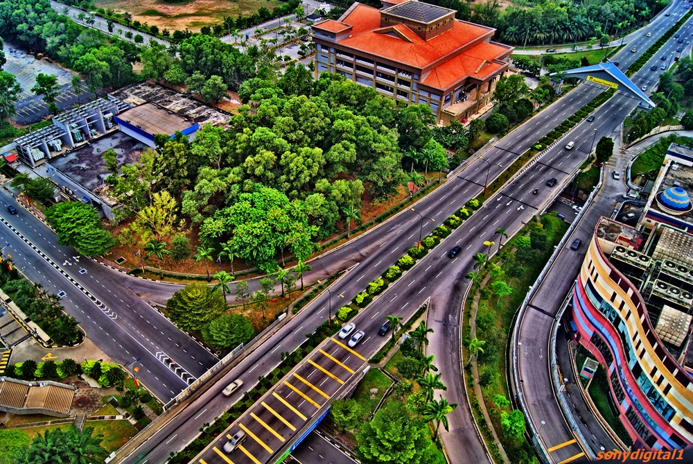
| Shah Alam HDR |
 |
| Shah Alam Sunset |
 |
| Plaza Alam Sentral |
 |
| Shah Alam Town City |
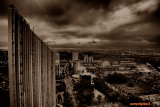 |
| Shah Alam BW |
Shah Alam is the state capital of Selangor, Malaysia situated within the Petaling District and a small portion of the neighbouring Klang District. It is located about 25 kilometres west of the country's capital, Kuala Lumpur. Shah Alam replaced Kuala Lumpur as the capital city of the state of Selangor in 1978 due to Kuala Lumpur's incorporation into a Federal Territory in 1974. Shah Alam was the first planned city in Malaysia after independence from Britain in 1957.
Malaysia grew rapidly after its independence in 1957 under the "Father of Modernisation", the second Prime Minister of Malaysia, Allahyarham Tun Abdul Razak Hussein. Shah Alam was once known as Sungai Renggam and was noted for its rubber and oil palm estates. Later, the same area was identified as Batu Tiga prior to Malaysian independence, and has been a centre of rubber and palm oil trade for centuries. The Sungai Renggam Plantation was earmarked for the development of a township by the Selangor government in 1963, and under the recommendations of V. Antolic, a town planning advisor from the United Nations, chose the present site strategically located between Kuala Lumpur and Port Klang.
Its current name was chosen by the then state Sultan of Selangor, Sultan Salahuddin Abdul Aziz Shah, after his late father Sultan Alam Shah. Many other monuments, buildings and even a street are named after the late Sultan. Shah Alam was opened in 1963 with the purpose of making it the administrative centre of Selangor once Kuala Lumpur was made a Federal District on 1 February 1974. With the consent of 8th Duli Yang Maha Mulia Sultan of Selangor, Almarhum Sultan Salahuddin Abdul Aziz Shah Al-Haj, Shah Alam was proclaimed the capital of Selangor on 7 December 1978 with an area of 41.68 square km, and administrated by a municipal council. Shah Alam had encountered several processes of extending its areas and the last was on 1 January 1997. Through the Gazette Plan 1190, Shah Alam was extended to 293 square km
Shah Alam was granted city status on 10 October 2000 with Dato' Haji Abu Sujak Haji Mahmud as the first mayor. He recently served as deputy Menteri Besar, or Chief Minister of Selangor. Abu Sujak declared the vision of making Shah Alam a modern city with a unique identity of "Bandaraya Melayu" or Malay City, showcasing the achievements of the Malay race in all sectors. In line with this identity, Shah Alam was declared the first city in the world with no entertainment outlets to avoid any vice activities.
Shah Alam is located within the district of Petaling and a portion of the district of Klang in the state of Selangor. Due to its recent expansion, it is bordered by the cities of Subang Jaya and Petaling Jaya in the east, the district of Klang in the west, the district of Kuala Selangor and Selayang in the north, and the district of Kuala Langat in the south. Shah Alam is also one of the major cities within the Klang Valley, an area in Malaysia comprising Kuala Lumpur and its suburbs, and adjoining cities and towns in the state of Selangor, due to the Klang River flowing through it on its way westward to the Strait of Malacca.
Shah Alam has a similar urban layout to Petaling Jaya or Subang Jaya with housing areas occupying most of the city (55.2 km2) and commercial centres scattered around the different 'Seksyen' (sections).[citation needed] There are 56 sections in total. Generally Shah Alam can be divided into north, central and south part. North Shah Alam consist of 18 Sections including Sections U1 and U2 and Kampung Melayu Subang. The Central Shah Alam is the 'main' part of Shah Alam. It is where all the state administrative building and agencies are situated. It consist of Section 1 until Section 24 seen in the map as beige coloured area. South Shah Alam consists of 12 sections including Section 25(Sri Muda), Section 30 (Jalan Kebun), Section 31 (Kota Kemuning) and Section 32 (Bukit Rimau). In the map, the south Shah Alam is seen as the light purple coloured area.
The city has a number of shopping malls (Plaza Alam Sentral, (also known as PAS), SACC Mall, Plaza Shah Alam (formerly known as Shah Alam Mall, also known as Plaza Masalam), Ole-Ole Seksyen 18, Anggerik Mall and Kompleks PKNS). Vibrant commercial areas are situated mostly at the city centre (Seksyen 14), Seksyen 13 and Seksyen 9. There are no cinemas in the city.
All of the main roads and streets in Shah Alam including the new townships such as Setia Alam and Kota Kemuning have signs with their names shown in both Roman and Jawi scripts.
See also List of sections in the city shah alam